Blog
Back to normal
After last week's epic ride, this week it was back to a more normal 21 km round through the woods with my daughter. Here she is coming to the top of a really steep bit, hence the low posture.

Hell
The Jan Janssen Classic has been a tour for road bikes for 28 years, but the last few years mountain bike routes have been added, 'the hell of Ede-Wageningen'. Today about 6000 mountain bikers and road cyclists took part. So that made it quite an event! The weather was perfect (except for the strong wind); not too hot or cold and the rain held off until I was already finished. It has been quite dry here, but in the last couple of days there has been some rain, so the ground was just about perfect. For the mountain bikes there is a choice of 56 or 95 kilometers, but 56 was quite enough for me. The tour was very well organised, with efficient signing in using bar codes, clear and comprehensive signposting, a nicely chosen route and cuckoos and sky larks to listen to as we went along. Of course seeing it started in Wageningen I knew most of the paths, but nevertheless there were a few sections that were new to me (perhaps in the areas not normally open, I'm not sure). There was a nice friendly atmosphere - stopping for a wine-gum break it was surprising how many people asked if everything was all right and did I need any help? Even with nearly 1000 mountain bikers, it was not crowded in the woods, people set off at different times, so we were all spread out and it was only at the start and breaks that you got a sense of just how many participants there were. All in all a great tour. Maybe if I had attempted the 95 kms it would have been different, but this was more like heaven than hell!


Official website: http://www.janjanssenclassic.nl
Tønsberg

Tønsberg is a small town in the south of Norway, about 1/2 hour down from Oslo. I was lucky enough to have to visit it for my work last week, and even more lucky that I had some hours free to go cycling. I was able to hire a decent hardtail from the tourist information office, where they were also very helpful and leant me a map. The map did not really have off-road tracks on it, though some routes were on gravel. However, I had found a route on gpsies.com which looked promising, and did my best to follow that. Mostly it was indeed an excellent route, though there were parts where either the track just did not exist, or I later concluded that I was following a more difficult route than necessary and that an easier track was running parallel to the difficult footpath I was scrambling up. As a consequence, my route was very varied including a small amount of cycle paths next to main roads, a certain amount of small asphalt lanes, some nice gravel tracks through woodland (very pretty until you stopped and the mosquitoes attacked) and some singletrack/footpaths which were, in parts, very difficult and technical (i.e. I got off and walked on the really steep bits). All in all, a great ride.
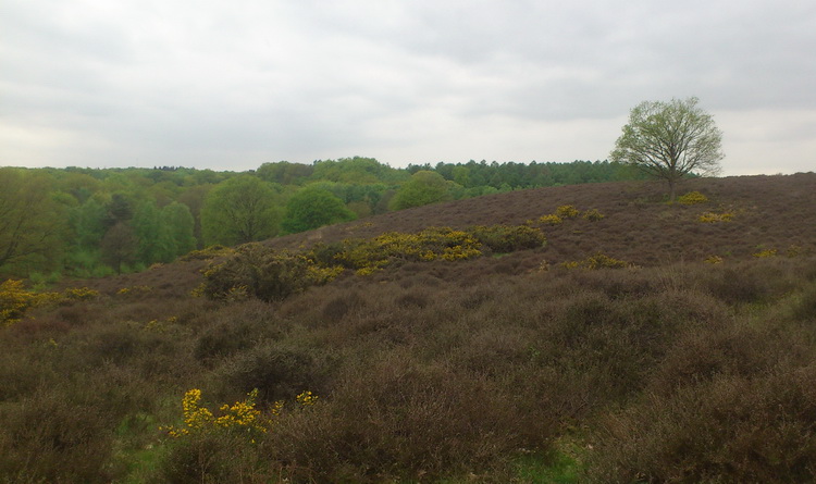
The Posbank
Without doubt, one of the best official mountain bike routes in the area is the Posbank, officially known as the Rheden mountain bike route. It is 52 km long and over 500 m of elevation. For the Netherlands, that is very hilly! Not suprisingly then, it is very popular, so when I took my daughter we made sure that we kept away from the weekend and bank holidays, instead going on the Friday between Ascension day (a holiday here) and the weekend. We had chosen a good day, it was dry but not too warm, and indeed there were not too many mountain bikers on the trail. 52 kms was a bit long, so we cut across the middle, taking a shorter route which was about 35 kms. The area can be divided into a relatively flat northern half and a hilly southern half. The latter of course is much more fun, so we missed out the northern part, which meant that in our 35 km we still had over 460 m of elevation. The route was very well signposted (apparently there are over 1000 boards), but one or two crucial ones were missing (and then it would have helped if my GPS device did not display the route I had uploaded to it in exactly the same way as the alternative routes show on the base map). It is well-maintained, and you have to pay for that buy buying a permit (you can get it online here). Although none of the ascents were really long, there is a whole succession of one after the other, so that by the time we got back to our starting point our legs were certainly feeling a bit weary. The landscape was looking quite spectacular, with the fresh new green leaves of the beech and oak trees looking wonderful, and the gorse coming into flower on the heathland. A great ride!
The Eifel
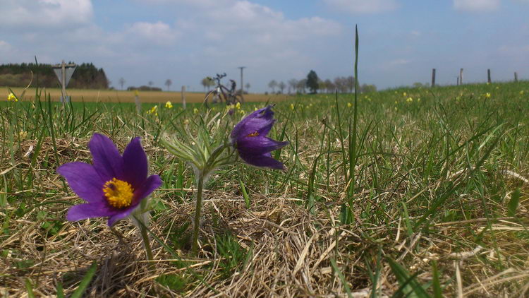
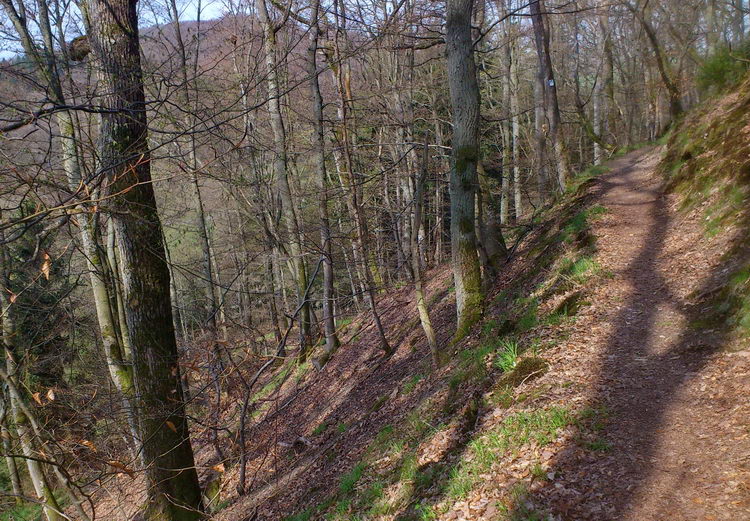
The Veluwe and other areas near to Wageningen are great places for mountain biking, but another advantage of Wageningen is that you are close to the 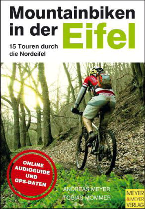 German border. Only two and a half hours driving and you are in the Eifel. The Eifel is an area of chalk hills, or rather an elevated chalk plateau, with relatively steep-sided valleys cut into it by a number of rivers. That has a number of consequences. The chalky soil means that the area is bursting with orchids and other rare plants, and the valleys mean that even though the highest point is only about 600 m, you can still easily clock up a thousand meters of elevation in three hours cycling. Around Bad Münstereifel there are a number of waymarked tracks, that are also available for download as GPX files. They have some quite nice routes, although it must be said that a higher proportion are on tarmac (albeit mostly without cars) than I prefer. The same cannot be said for the book on the right. The authors have taken great care to keep off-road as much as possible, and have come up with a great selection of routes. If you buy the book, you can also download the routes as GPX files, and you can also download audio files which give you instructions about where to turn and so on by listening to an mp3 player as you go round the routes. I don't speak German, so could not really test out if this is a practical idea or not, but with GPS you also find your way round with no problem. The routes are quite varied in how steep and challenging they are, and they are graded for both how technically difficult and how fit you need to be to go round them; very handy. Within each route there is also quite a lot of variation as well. The two photos below illustrate that nicely, from the Pasque flower (and Oxlip) meadows (with bike in background) to the singletrack with the impressive drop in the woodland. As usual with such scenes, the photo does not do justice to the track; it was only just wider than my handlebars, and round the corner there were lots of tricky roots all over the path. More to the point, the slope to the left was so steep that you could be sure that if your attention wandered and your front wheel went over, it would be like plunging over a ravine. Not a risk you take when cycling a little nearer to Wageningen very often.
Evening light
At long last the clocks have gone over so it is light until later in the evenings again. Together with the warmer temperatures, that can only mean one thing; out on the bike!