Blog
Goudsberg tour
On its website, the Goudsberg tour organisers describe it as one of the most beautiful tours on the Veluwe. And it is true! It starts off running alongside the famous Wekeromse Zand (an incredible landscape of inland dunes), which unfortunately you are not allowed to cycle through, and then there is kilometer after kilometer of intricately twisting singletrack through beautiful deciduous woodland. The combination of turning leaves and bright green mossy forest floor was spectacular. After the break, the twisted woodland path continued, but then a series of very steep sandy hills (or rather, sand pits), with sharp descents and impossible ascents come into play. The combination of gradient and loose sand made me give up and step off the bike on multiple occassions. I was glad to see that virtually everyone else was getting off at the same points as well. There were hundreds of other people taking part, and a nice friendly atmosphere. By the end, after 45 km, everyone was looking quite tired. I was amazed to see when I got home that it was only 500 m elevation, it felt like much more. All in all, a wonderful route.


Bottom photo by Joop van den Brand, others by Andrew Spink
Apeldoorn Official Route
The official Apeldoorn route is 50 km long, and for much of that 50 km you are cycling on sand. Not much tarmac, and if you do it at the end of a dry summer, a lot of loose and difficult patches. In case you are not familiar with it; cycling through dry sand is like cycling through powdery snow. That means hard work on the uphills and some skill required to keep upright on the downhills. By the time you get back to your stating point again, if you are not feeling some tiredness in your legs you must be very fit. But that was in August, after a bit of rain I am sure that the trail will be quite fast and then the 50 kms will fly by.

The route goes through some beautiful woodland, mostly mixed broadleaf, and there are some spectacular views across open sandy heath. Rather surreally you come across the art nouveax Radio Kootwijk building in the middle of one such heathland. It was built in the 1920 to maintain radio contact with the Dutch colony in Indonesia, initially with Morse transmissions and later with short-wave radio.
The route officially starts in Apeldoorn, but if you are coming from the south you can also park in Hoenderloo for instance. The signposting is excellent (August 2013), although watch out that in a few places the signposted route does slightly differ from the GPS route.

Mountainbiking in the Hochwald
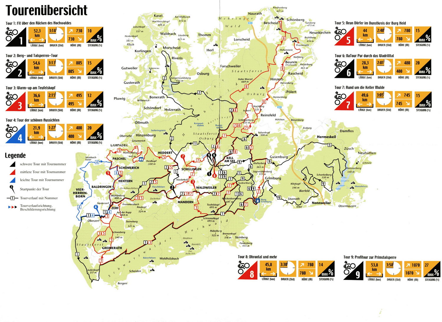
Hochwald is an area in the Southwest of Germany, on the border of both Luxembourg and France. That means it is a bit off the beaten track. It is hilly to mountainous (valleys at 250, tops 700m) and with vast areas of forest (the name means 'high forest'). If that sounds to you like it would be an excellent location to take your mountain bike, then you would be right. There is a good network of signed trails and if you travel a half hour or so to the West there is a trail network based around Sankt Wendel (famous for being a previous location of the mountain bike world cup).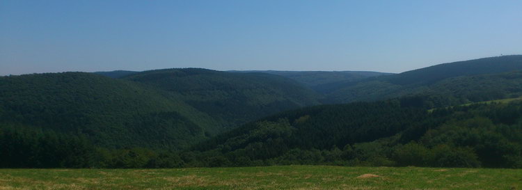
The official routes are all available as GPS from gpsies.com and also as printed leaflets available from tourist information offices. The leaflets are with good quality maps, height profiles (a bit small) and detailed instructions. The only thing they lack is information about what the surface (tarmac, gravel, singletrack etc) is like. It is certainly not enough to expect to be able to follow the signs as some are missing or damaged (see below), some are overgrown and some are a bit hidden. If you do not have GPS, the map and description should do.
")

There are three categories of track (blue, red and black). There is only one blue route, and it has nice views, but all tarmac. If you are used to the flat Netherlands then even the blue route feels very hilly, so this can be a good one to start with. The black routes are tougher than the red routes, partly because they are longer, but also because they have more interesting surfaces. Quite a lot of the red tracks are on gravel forest roads, whereas the black ones have more singletrack. The roots on the photo above are a good example. However, the black routes are also rather long, which is all very well, but not so convenient if you want to combine mountain biking in the Hochwald with a family holiday. Fortunately that is easily solved, most can be cut short (see some examples on gpsies).
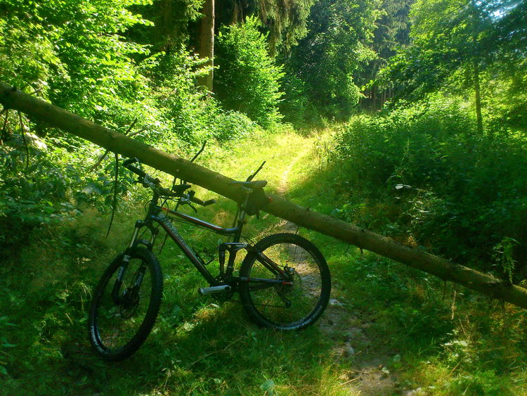
As the name implies, the Hochwald has a lot of forest. Much of it is conifers, with huge trees and fern understory reminiscent of the Black Forest. But there are also large areas of varied mixed and broadleaved woodland.
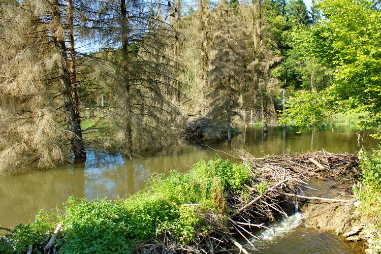
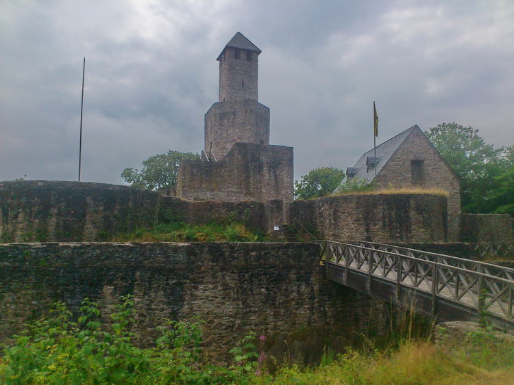
There are a couple of areas which are rather special. The Wadrilltal has very impressive nature, including a couple of beaver dams, and a magnificent medieval half-ruined castle, which you can climb all over. Quite a few of the official routes run through or across that valley, which was definitely a good decision.
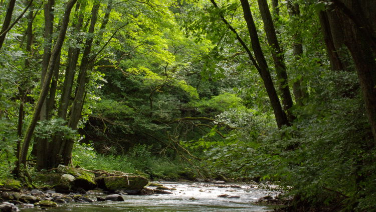
The Ruwertal (below) has fewer mountain bike routes running through it, although the long distance cycle path going to Trier does pass that way, but if you venture off the official routes and follow some footpaths/bridleways then there is both some challenging cycling and really beautiful landscapes.

Wild boar
The Veluwe, which is the area of sandy forest to the north of Wageningen, is locally famous for having a large population of wild boar. But the strange thing is that, despite having spent many hours on the mountain bike, in all weathers and at all times of years, I have never seen a single one there. Until today. We were out cycling near Mossel and all of a sudden a young one ran off in front of us. And then about six more scattered and ran off. They were still young enough to have their ginger and white stripes, but quite a large size already. Wonderful! Fortunately I did not make the mistake of missing the show by fishing for my camera, but that does at least mean that you can see that the flowering heather is also quite spectacular at the moment.

Nijmegen Red route
(The red route has been renewed. See here.)
I am always surprised at how close Nijmegen is. If you go there from Wageningen on a weekday, odds on you will be stuck in traffic for ages, so it feels like a long way. But on a Sunday afternoon, you are there in only half an hour. Half an hour, but a world away. The landscape is completely different from here because of one dominant factor - hills. Whereas you have to go out of your way in the woods round here to gain a few meters of elevation, by Nijmegen you could almost imagine you were in another country. Maybe that is because Germany is less than ten kilometers away, so you are almost. The official signposted routes there, both 'red' and 'green' ('rood' and 'groen')  make the most of the elevation,with numerous hills and relatively few flat bits. The tracks are in attractive woodland and it is an enjoyable route. The routes are signposted, but unfortunately they are notorious for people thinking it is amusing to steal the signs, so if you have a GPS, taking the track file with you is a good idea. Even if you do not normally use GPS to navigate, you can copy the track to your phone and make sure you have an app like Oryx Maps installed so that, should you miss a signpost, you can find your way back to the trail. It also makes a huge difference what time of year it is. I was last on the Red Route a couple of years ago in December, and still have distinct memories of deep slithery slurry. Hard work. Last weekend it was completely dry. That came with its own problem. On some of the downhills people have made little ridges, so that even mountain bikers with my level of skill can bounce into the air for a short distance with no problem all. Great fun. But landing on a pile of dusty sand that will just slip away from under your wheels made many of those jumps just a little too scary for me. All in all, great trails, and nice they are so close.
See also: Red route renewed
